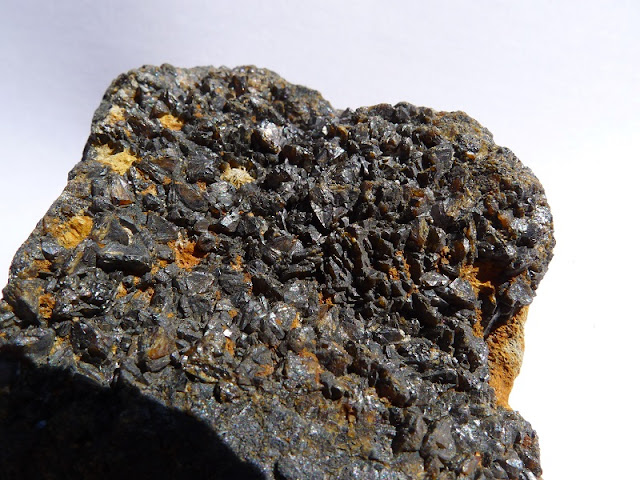
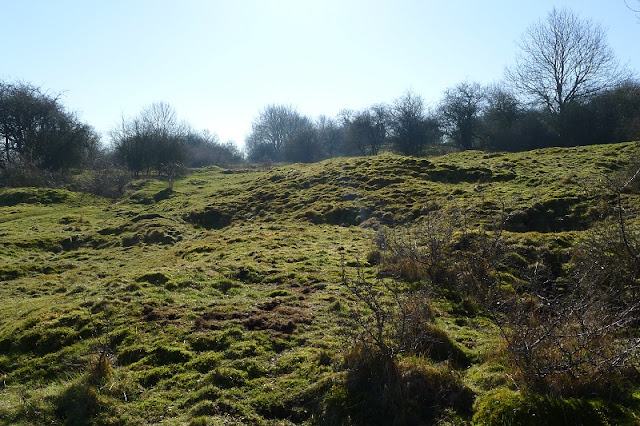
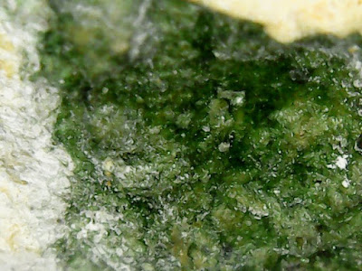
Magpie Mine and True Blue Mine

I visited Magpie Mine and True Blue Mine on the 12th May, 2019.  True Blue Mine can be seen on the lower right hand side of the map below with a grass track leading to it, Magpie Mine is labelled.

Situated close to Sheldon, the best approach is via the B5055 either from the west A515 (Buxton to Ashbourne)  via Monyash or from Bakewell to the east.  There are a few places to park on the verge by the entrance to Magpie Mine with both Mines within easy walking distance.

Magpie mine is a tourist attraction and is run by the PDMHS (Peak District Mines Historical Society).  Having only closed as recently as 1958 its one of the best preserved lead mines in Derbyshire. 


Background

Magpie mine has a long history and records show it dating back to about 1740 where it was one of many mines located in the same area.  It had a somewhat checkered history of opening and closing over the years, often due to issues with water and flooding.  There was a successful and profitable operation between the years of 1813 and 1820 following many years of exploratory work to find new ore veins.  This then tailed off due to issues with water and their inability to drain it. 1824 saw a new pump engine installed and over 800 tons of lead were mined in 1827 but water caused problems again by 1830 with the mine closing again in 1835 with investors refusing further funding.

During the period of 1824 to 1835 many legal disputes resulted between competing mine owners  operating separate shafts in the same location brought on by Magpie breaking into veins currently being worked by others.  Many legal battles finally culminated in episodes of violence and eventually death when in 1833 three Redsoil miners were killed and others injured as a result of tar and straw fires lit by Magpie miners underground in an attempt to drive out the opposing miners.  A 'Widows' curse is said to have come into affect following the subsequent acquittal of the Magpie miners on charges of murder.

1839 saw the mine reopened and with the help of Cornish miners the mining system improved and expanded and the introduction of a larger Pump engine.  This allowed a new shaft to be sunk to 684 feet in depth but this quickly flooded as it was beyond the capability of the installed pump to drain.  The mine again closed following lack of people willing to invest any further.

It was reworked again from 1868 following the installation of a larger pump and then construction on the Magpie Sough undertaken in 1873 and completed in 1881.  Mining continued but became increasingly more difficult facing geological difficulties as well as falling ore prices resulting in the mine again closing by 1883.  The construction of the sough was said to have cost upwards of £18000 which was a considerable sum in those days!

The mine continued to operate on a small scale over the years following 1886 with True Blue mine being incorporated into a new company in 1913.  Much money was poured into it over the following years with little return until it again closed in 1924.

The mine was subsequently reopened in 1951 and a new winder and steel headgear installed.  The mine was pumped dry but no sizeable ore body found, resulting in the mine finally closing for the last time in 1958.

Mineralogy

Mindat lists the following minerals from Magpie Mine:

Calcite
Cerussite
Chalcopyrite
Cinnabar
Galena
Pyrite
Quartz
Zinc Blende

I have found no listings for True Blue Mine

Minerals found

The only site searched and specimens found was True Blue Mine:

Galena
Fluorspar
Baryte
Calcite
Gypsum *  

* The Gypsum specimen was found in a rubble heap alongside the mine. Unsure whether this originated from the mine or not, it was not the only piece. 

 Some useful references

Historic England entry for Magpie Mine  

Mindat entry for Magpie Mine

PDMHS entry for Magpie Mine

Historic England entry for True Blue nucleated lead mine 

TRUE BLUE MINE - CAPPED SHAFT AND GIN CIRCLE


NEARBY POND BUT AGRICULTURAL IN ORIGIN 


VIEW OF MAGPIE MINE FROM TRUE BLUE MINE


ENTRANCE TRACK TO MAGPIE MINE


AGENT'S HOUSE WITH MINE BEHIND


THE SQUARE CHIMNEY


BOLE SHAFT - FROM 1789


SHUTTLEBARK ENGINE SHAFT - FROM 1760


WINDING DRUM ON WINDING HOUSE - FROM 1869


CORNISH ENGINE HOUSE - FROM 1869


STEEL HEADGEAR AND CAGE  - FROM 1950's


CAGE OVER MAIN SHAFT


SPOIL HEAPS


REPLICA HORSE GIN


GALENA IN BARYTE


FLUORSPAR


BARYTE

CALCITE


GYPSUM


Ratchwood and Rantor Mines

I visited the Ratchwood and Rantor Mines on the 27th of February, 2019.  The mines are situated in a valley to the right of the Wirksworth to Middleton Village road (B5023) about 700 yards from the Wirksworth end.

There are a few places to park on the left hand side of the road at old entrances to the now disused Middle Peak Quarry.  However, I'm not sure how easily the mines are accessed from this road so I chose to park at the National Stone Centre's main car park off Porter Lane (B5035) and walked the half mile or so to the mines, as it's a pleasant stroll to the bottom of the valley and a short walk up to the mines themselves.


From the National Stone Centre it's self, follow the rough stone road way down the hill to the left going round the bend till a path presents itself on the right hand side.  Take this and then take the first path downhill to the left and continue until you reach a bridge with a path under it on the right hand side.  This is  Old Lane and follow this down through the woods till it opens up on the right hand side. You should be able to see the Mine's spoilt heaps up the valley to the right and after about another 100 yards there is a clear path up to them.

Background

The mines accessed the Ratchwood and Orchard veins respectively and appear to date back to the late 1600s and remained in operation until the 1870s.  Ratchwood lying to the west and Rantor to the east.  Both were worked as Lead mines and we said to be some of the most productive in the area in 1863 but output was down to just 4 tons and 3.8 tons respectively by 1872.

Locally, the Rantor vein was known to have been worked long before with initial workings hindered in the early 1630s by reaching the natural water table.  It was not until later in the 1600s that a sough allowed it to continue with a further extension in the early 1700s to Ratchwood and Rantor allowing  deeper mining.

On older documentation, pre 1880, the two sites shafts are labelled Nether Ratchwood and Orchard.

To the west of Ratchwood mine are the remains of several buildings including the mine office and reckoning house, along with other ruined structures.

There was little occurrence of Fluorspar in these mines so there is no evidence of them subsequently being reworked for Fluorspar unlike many of the Derbyshire Lead mines and spoil heaps.

Mineralogy

Mindat lists the following minerals as being identified at Ranter mine by reference of the 'UK Journal of Mines and Minerals Number 13': 

Anglesite
Baryte
Calcite
Cerussite
Galena
Pyrite
Sphalerite (Zinc Blende)

Minerals found

There was little to find at Rantor Mine but Ratchwood revealed the following:

Calcite
Baryte
Galena
Zinc Blende
Fluorspar

Some useful references

Historic England Listing   (A good source of detailed information)

Lead Miners Heyday (pdf)   (Contains some references to Ratchwood and Rantor)

Derbyshire Dales Documents: Middleton by Wirksworth Conservation Area Appraisal-part 2 (pdf)  (Many old maps and a good source of historic information of the area and mining)


PATH HEADING UP HILL TO RANTOR MINE


RATCHWOOD MINE SPOIL HEAPS


SPOIL HEAPS - DRESSING FLOOR ABOVE


VIEW OVER TO BOLEHILL


CAPPED SHAFT


VIEW FROM RANTOR MINE


SMALLER ENCLOSED REMAINS OF RANTOR MINE


ZINC BLENDE WITH GALENA  IN BARYTE


BANDED ZINC BLENDE ATOP OF LIMESTONE


ZINC BLENDE CRYSTALS ON TOP WITH BARYTE


FLUORSPAR AND BARYTE


DOGTOOTH CALCITE CRYSTALS


BARYTE WITH THIN VEINS OF GALENA


MICROSCOPE VIEW - BANDING AND THIN VEINS


Dovegang Mines

I made two trips to this locality over the 26th and 27th February, 2019.  It's situated between Wirksworth and Cromford on the high ground overlooking Dean Quarry to the left of Porter Lane and the Wirksworth Cromford road (B5036) intersection.

The site is now managed as a nature reserve by Derbyshire Wildlife Trust and access to the reserve is via the entrance to Dark Lane.  This is off Porter Lane, on the right hand side just after the entrance to the Adventure Centre on the left hand side.  There is possibly room to park here but I chose to park in the car park just up the road at the National Stone Centre and walked from there.


Background

Lead had been mined in the Wirksworth area since Roman times and this area was one of the first productive Lead mining areas in Derbyshire. Repton Abbey owned mines at Wirksworth in the 800s AD and Lead mining was an established industry by 1086 when mines in the area were recorded in the Doomsday Book.  In 1540 144 tons of Lead was mined at Deans Hollow between Wirksworth and Cromford.

The Dovegang mines were named after the Dove Gange (Dovegang) vein which ran in an east to west direction from Black Rocks over to Middleton.  With it's tributary veins it covered an area of about 200 acres.  In 1632 records clearly show a shaft known as the Gyn Pitt and with a shaft  apparently 240 foot deep.  There were problems with flooding which was not solved until the introduction of Derbyshire's first sough (drainage system) in the 1630's and improved upon by many more that followed.

There appear to have been many shafts dug across the area through the ages with other names such as California mine and Sliding Pits mine.

The 'Lead Miners Heyday: the great days of Lead mining in Wirksworth and the Low Peak of Derbyshire' document (a link provided in the reference section) is a fascinating history of mining in the area and full of interesting detail including the somewhat dubious acquisition in the 1600s of the Dovegang mines by the then Attorney General Sir Robert Heath and the removal of the locals mining rights.

Mineralogy

I have been unable to find any detailed information on minerals found at these mines.  It goes without saying that the primary Lead mineral was Galena.

Minerals found

The area contains some of the oldest mine workings in Derbyshire and as such appear to have been been heavily picked over the years.  Specimens were hard to find and being a nature reserve I did not want to disturb the spoil heaps.  However, I did manage to find a few samples as follows:

Galena
Pyromorphite
Smithsonite
Fluorspar
Baryte

Some useful references

Derbyshire Wildlife Trust: Gang mine

Lead Miners Heyday pdf

Wikipedia: Derbyshire Lead Mining History

Gang Vein and Gulf Fault


SIGNAGE AT ENTRANCE


LANE TO DOVEGANG MINES


ENTRANCE STYLE


SPOIL HEAPS IN THE AREA OF GYN PITT


ANOTHER VIEW


COVERED SHAFT


OLD WORKINGS AT EDGE OF SITE NEAR DEAN QUARRY


DEAN QUARRY


CAPPED SHAFT NEAR CALIFORNIA MINE


VIEW ACROSS THE FIELDS TO MIDDLETON FROM THE WEST OF THE SITE


VIEW ACROSS TO BLACK ROCKS FROM THE EAST OF THE SITE


OLD LIME KILN LOCATED DOWNHILL TO THE EAST, IDENTIFIED FROM AN 1884 OS MAP


GALENA AND BARYTE


PYROMORPHITE


PYROMORPHITE - SAME SAMPLE VIEWED WITH THE DIGITAL MICROSCOPE


SMITHSONITE


SMITHSONITE - THROUGH THE MICROSCOPE


FLUORSPAR - FROM THE CALIFORNIA MINE AREA


ENCRUSTED FLUORSPAR CUBES FROM THE GYN PIT SPOIL HEAPS