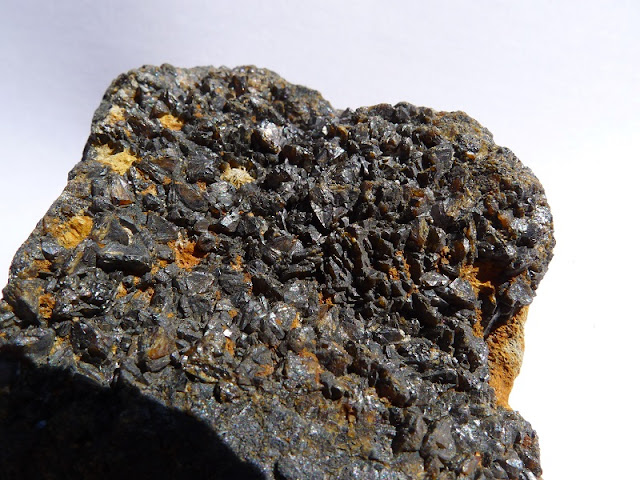
I visited the Ratchwood and Rantor Mines on the 27th of February, 2019. The mines are situated in a valley to the right of the Wirksworth to Middleton Village road (B5023) about 700 yards from the Wirksworth end.
There are a few places to park on the left hand side of the road at old entrances to the now disused Middle Peak Quarry. However, I'm not sure how easily the mines are accessed from this road so I chose to park at the National Stone Centre's main car park off Porter Lane (B5035) and walked the half mile or so to the mines, as it's a pleasant stroll to the bottom of the valley and a short walk up to the mines themselves.
From the National Stone Centre it's self, follow the rough stone road way down the hill to the left going round the bend till a path presents itself on the right hand side. Take this and then take the first path downhill to the left and continue until you reach a bridge with a path under it on the right hand side. This is Old Lane and follow this down through the woods till it opens up on the right hand side. You should be able to see the Mine's spoilt heaps up the valley to the right and after about another 100 yards there is a clear path up to them.
Background
The mines accessed the Ratchwood and Orchard veins respectively and appear to date back to the late 1600s and remained in operation until the 1870s. Ratchwood lying to the west and Rantor to the east. Both were worked as Lead mines and we said to be some of the most productive in the area in 1863 but output was down to just 4 tons and 3.8 tons respectively by 1872.
Locally, the Rantor vein was known to have been worked long before with initial workings hindered in the early 1630s by reaching the natural water table. It was not until later in the 1600s that a sough allowed it to continue with a further extension in the early 1700s to Ratchwood and Rantor allowing deeper mining.
On older documentation, pre 1880, the two sites shafts are labelled Nether Ratchwood and Orchard.
To the west of Ratchwood mine are the remains of several buildings including the mine office and reckoning house, along with other ruined structures.
There was little occurrence of Fluorspar in these mines so there is no evidence of them subsequently being reworked for Fluorspar unlike many of the Derbyshire Lead mines and spoil heaps.
Mineralogy
Mindat lists the following minerals as being identified at Ranter mine by reference of the 'UK Journal of Mines and Minerals Number 13':
Anglesite
Baryte
Calcite
Cerussite
Galena
Pyrite
Sphalerite (Zinc Blende)
Minerals found
There was little to find at Rantor Mine but Ratchwood revealed the following:
Calcite
Baryte
Galena
Zinc Blende
Fluorspar
Some useful references
Historic England Listing (A good source of detailed information)
Lead Miners Heyday (pdf) (Contains some references to Ratchwood and Rantor)
Derbyshire Dales Documents: Middleton by Wirksworth Conservation Area Appraisal-part 2 (pdf) (Many old maps and a good source of historic information of the area and mining)
 |
| PATH HEADING UP HILL TO RANTOR MINE |
 |
| RATCHWOOD MINE SPOIL HEAPS |
 |
| SPOIL HEAPS - DRESSING FLOOR ABOVE |
 |
| VIEW OVER TO BOLEHILL |
 |
| CAPPED SHAFT |
 |
| VIEW FROM RANTOR MINE |
 |
| SMALLER ENCLOSED REMAINS OF RANTOR MINE |
 |
| ZINC BLENDE WITH GALENA IN BARYTE |
 |
| BANDED ZINC BLENDE ATOP OF LIMESTONE |
 |
| ZINC BLENDE CRYSTALS ON TOP WITH BARYTE |
 |
| FLUORSPAR AND BARYTE |
 |
| DOGTOOTH CALCITE CRYSTALS |
 |
| BARYTE WITH THIN VEINS OF GALENA |
 |
| MICROSCOPE VIEW - BANDING AND THIN VEINS |
No comments:
Post a Comment